The project
A map you can travel back through
Most parish histories are told year by year. This one is told place by place: pick a field or a house, and follow it through every record that mentions it.
How it works
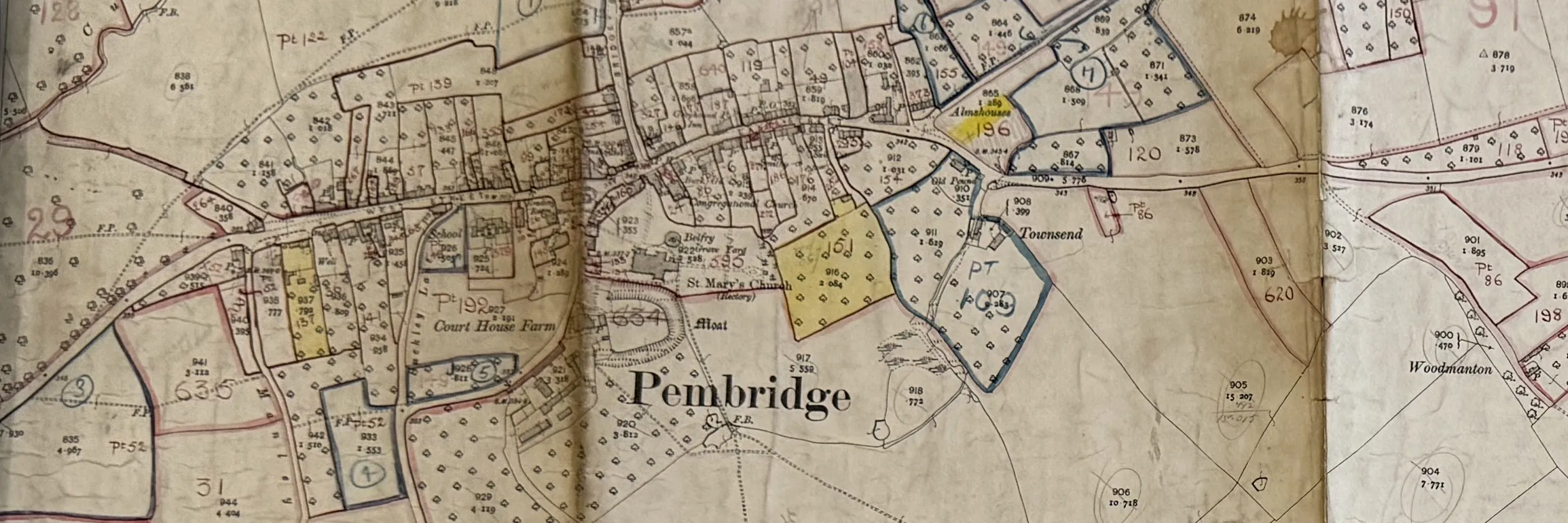
Every source is tied to the same map. The tithe survey of 1840 numbered every plot in the parish; the valuation of 1910 numbered them again on the Ordnance Survey sheets; the farm survey of 1941 did it once more. Fit each map onto today's map and the plots line up, so one tap on a field brings up every record of it.
Behind the map sits one table: a row for each place and a column for each date. The map, the exhibition panels and the book are all drawn from that table, so a correction made once appears everywhere.
The sources, by period
| Date | Record | Where it is | Status |
|---|---|---|---|
| Before 1840 | Court rolls, land tax, enclosure awards and estate maps | Herefordshire Archive and Records Centre; The National Archives; Longleat | Started |
| 1840 | Tithe map and apportionment: owner, occupier, name, use and area of every plot DB65/20/1 | Herefordshire Archive and Records Centre | Transcribed |
| 1904 | Ordnance Survey 25-inch map, second edition | Herefordshire Archive; National Library of Scotland | In use |
| 1910 | Valuation book and maps: owner, occupier and value of every property AG9/44 · J26 | Herefordshire Archive and Records Centre | Transcribed |
| 1910 | Valuation field books: a description of every property IR 58 | The National Archives, Kew | Visit planned |
| 1941 | National Farm Survey: every farm, its fields and its farmer MAF 32 · MAF 73 | The National Archives, Kew | Visit planned |
| 1841–1921 | Census returns, directories and electoral registers | Online and at Hereford | To do |
| Living memory | Photographs, recordings and stories | In the village | Gathering |
How we work
Credit every source
Every document is shown with the holding archive's permission and its credit line. Herefordshire Archive Service and The National Archives have both given permission for the exhibition.
Keep the original reading
A transcription is never overwritten. A correction is recorded beside the first reading with the initials of whoever made it and the date, so anyone can check it later.
Ask before naming
Nobody living is named, and no photograph of a living person is shown, without their agreement.
Build on what exists
The late David Lovelace, the Herefordshire landscape historian, digitised the Pembridge tithe map before his death in 2026. His work is the base of our field map.