Progress
The project so far
What has happened, newest last, with what comes next.
The idea
A layered map of the parish is proposed: pick a house or a field and travel back through it.
David Lovelace's archive
The online archive of the late David Lovelace turns out to hold a great deal of Herefordshire's landscape history, including material on Pembridge.
David's tithe map
The group's copy of David's digitised tithe map holds 1,487 fields, 637 of them with their 1840 details.
Permission from The National Archives
The National Archives gives permission to show its tithe and farm survey records in the Parish Hall, free of charge.
Permission from Herefordshire Archive Service
Photographs taken under the archive's permit may be used in the exhibition, the book and online.
First visit to Hereford
Every page of the 1840 apportionment photographed, with the 1910 valuation book, the valuation maps, both tithe maps and the Marston enclosure award.
The apportionment transcribed
All 1,510 plots typed up and checked. 1,475 of the 1,487 fields on the map now carry their 1840 owner, occupier and use.
The valuation book transcribed
Both sides of the 37 photographed pages, and a fair copy of the book for reading on screen.
The first map
The parish's land use in 1840, field by field.
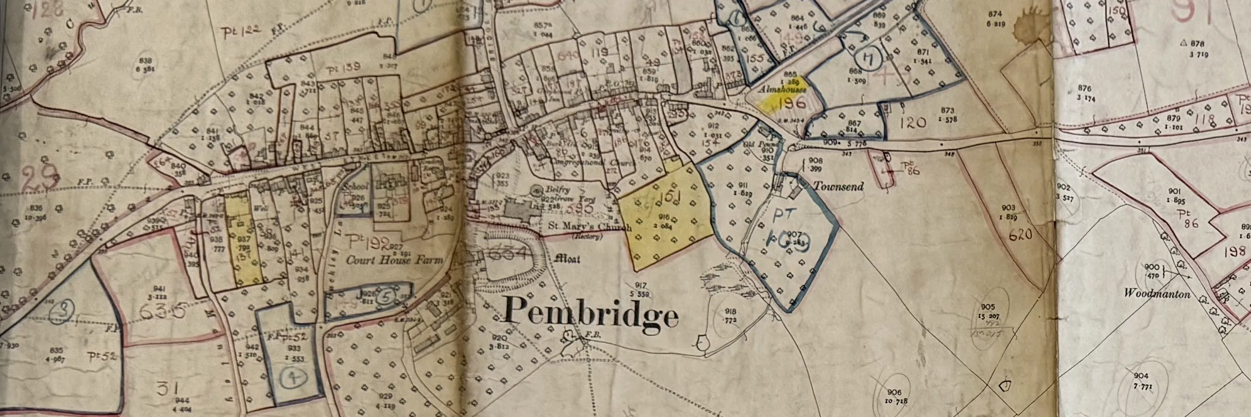
The 1910 maps fitted
The village, Weston and Marston sheets fitted to the modern map, to within about ten metres.
Next: back to Hereford
The missing valuation pages, land tax and rate books, and the estate sale papers.
Next: The National Archives, Kew
The 1910 field books and the 1941 farm survey for Pembridge.